Welcome to the SpatialScale Blog!
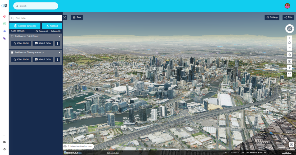
Hey there! Welcome to the SpatialScale Blog, your go-to place for all things geospatial. SpatialScale is a cloud platform designed to help you inventory, store, and analyze location-based data quickly and easily. Our goal is to make geospatial technology accessible and affordable for everyone. We’re here to share the knowledge and tools you need to study the world, with the world.
What Can You Expect?
We’ll be publishing updates on our platform, new use cases, videos, and events where SpatialScale is featured. If you love Open Data, GeoAI, 3D visualization, mashups, and maps, this blog is for you!
Early Access Benefits
We’ve recently moved from private to open beta. As a thank you for your patience, members who register and subscribe before our version 1 release will get a 10% Early Adopter discount.
Join Us on This Journey
We’re excited to grow the platform and explore the world with you. Dive into the amazing world of geospatial data and discover how you can make the most of it.
Explore More
Check out our platform to learn more. Need help? Visit our help center for guides and support.
Thank you for being part of our journey. Let’s analyze the world together!